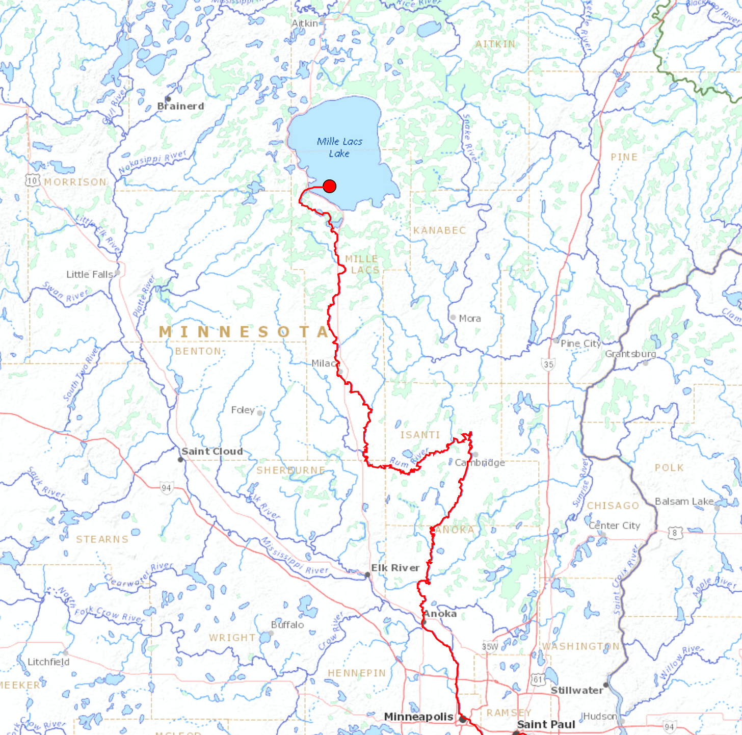
It’s very easy for me to get distracted by maps. But they’ve invaluable for understanding the scale and scope of a story like this history of the Great Pine Forest. I’m unable to find a map that has all the rivers I want on it. When it comes time to publish a book I’ll probably need to commission a map (I believe my friend Ted Melillo has a “map guy” to whom he can refer me). In the meantime, a half hour of searching on the web led me to a REALLY COOL app provided by the USGS called Streamer. It lets you trace streams in the United States, in both directions. I found this five years ago, in 2020 — just double-checked and it still exists despite DOGE!
The first thing I tried was looking up the Rum River, which flows from Mille Lacs Lake into the Mississippi (at Anoka) and carried logs to the lumber mills of St. Anthony Falls in Minneapolis. Streamer was able to provide a “downstream trace” beginning at Mille Lacs and passing through Minneapolis. It didn’t stop there, of course. Downstream traces end at the ocean.
Upstream traces, on the other hand, produce branching diagrams of all the streams that feed a river. And the app can provide detailed reports including the names of all the streams, towns and cities, and features of the waterways with links to more USGS info. They’re ideal for locating lumber towns and then seeing the forests that fed the mills in those centers. As I identify more places I want to study, I’ll do this each time. Below are some initial traces upstream from Minneapolis, Stillwater, and Saginaw. This is going to be ridiculously useful in helping me understand how these lumber regions developed and grew, where different regions sent their logs or lumber; and to answer other questions like why did Thomas Walker locate his mill in Crookston (it’s on a different river system).
Rivers feeding the Mississippi at St. Anthony Falls:
Rivers feeding Stillwater, Minnesota:
Rivers feeding Saginaw, Michigan:
The north-flowing Red River watershed, west of the Mississippi, where Walker’s Crookston mill was located. Crookston was just beyond the western limit of the pine forest:


Whoa. Ridiculously interesting. Waterways for the win! Didn’t know you lived/worked in Midland, Patrick. I grew up in the thumb, outside Lapeer, tiny town called Otter Lake. Farm country.
Something related I came across a while back was https://river-runner-global.samlearner.com/ which does a complementary visualization of water movement... A bit of a rabbit hole, this stuff.