My Research Trip to the Canadian Border
This week I went up to the Canadian border. I didn't cross into Canada, but I drove along the edge of the US for quite a while. First I visited Baudette Minnesota, which is on the Rainy River. It's the county seat of Lake of the Woods County, which is why the county's history center is there. The lake is a few miles northwest, at the mouth of the Rainy River. Baudette's population is slightly over a thousand, and it is known as the Walleye capital of the world. I did not see the giant walleye they call Willie.
I visited the museum in Baudette, where I will be doing some work in the coming months editing the "story" that they are writing to describe their collection to visitors. They have a LOT of stuff in the museum, and it will be fun working on that project. I didn't have a chance to take any pictures while I was there -- or rather I forgot about it until I was already on my way to International Falls. So these photos have been from the museum's website. I'll take some of my own next time I visit.
Next I got on state highway 11 and drove west to International Falls. The road hugs the Rainy River, following it back to its source at Rainy Lake in the town of Rainier, just east of my destination. It's 137 miles from Rainy Lake to Lake of the Woods, and the river is the Canadian border the whole way, as far as I can tell. There's a bridge to Canada in Baudette and another in International Falls: between the two you have to cross in a boat or wait for the river to freeze. As I drove along, it seemed every house and farm on the other side was flying a Maple Leaf flag, just to remind people looking across that it was Canada.
I was actually visiting International Falls to observe a high school world history class that the local teacher is teaching based on my syllabus, so his students can get college credit at for it through my school. As the "sponsoring" professor, I have to visit and verify that the class is equivalent to mine. I spent the night in a hotel and went to the high school in the morning, running my own two classes via Zoom before observing the high schoolers learning about the rise of Augustus Caesar. Then I got a bite of lunch and headed to the local museum.
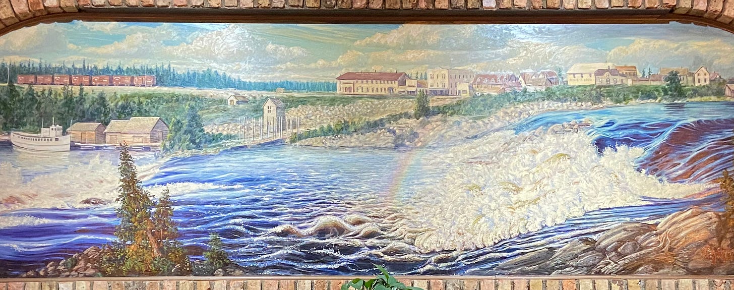
The city of about 6,500 is known locally as "The Falls", even though the falls actually don't really exist anymore. They were used first by the lumber mill and now the paper mill is right in front of where they used to be. I ate lunch at a place called The Library that had a nice mural of the falls, although after I asked about it some local experts pointed out that the railroad in the painting wasn't put in until the river was dammed and the falls eliminated. These experts were a father and son who had quite a bit to say about the lumber industry and town history. I got a lot of leads from them that I might never have run into on my own.
At the Koochiching County Historical Society I was able to follow up on some of these leads. I photographed about 175 pages of content, including a chapter of a dissertation that had been written about the Canadian paper industry, but included a chapter the author had researched in the Falls about the conflict between the conservationists and the lumbermen, which the guys I had met at lunchtime had clued me in to. I contacted the author, who is now a professor at a Canadian university, and he responded to my questions and sent a copy of an additional article he had written on the subject. So I've now got a lot of great leads to follow!


